Sector 2 – DHA City Karachi
Featuring the scenic Allama Iqbal Lake, Sector 2 of DHA City Karachi is further divided into 4 sub-sectors i.e. 2A, 2B, 2C, and 2D, and offers a range of residential plots, including 300 square yard options, to meet various housing needs.

Directions – Main Gate to Sector 2
Upon entering the main gate of DHA City Karachi, you will encounter a large roundabout known as DHA Square. Proceed straight through this roundabout onto the Main Boulevard, which is the primary road through DHA City, Sector 2 will be on your right, and Sector 3 will be on left. Continue driving for approximately 756 meters (2,480 feet) along this boulevard. Then, turn left onto the ‘2nd Main Street East’ to enter Sector 2. Notably, Sector 2 is conveniently located just about 75 meters (247 feet) from the main gate, making it one of the closest sectors to the entrance of DHA City. Sector 2 borders Sector 1 to the east and located right before CBD Commercial, opposite to Sector 3.
Plots for Sale in Sector 2
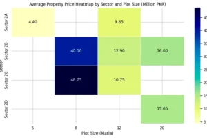
| Sector | Plot Size (Marla) | Plot Size (Square Yards) | Price Range (Crore/Lakh PKR) | Price Range (Million PKR) |
|---|---|---|---|---|
| 2A | 5 | 125 | 44 Lakh | 4.40 to 4.40 |
| 2B | 8 | 200 | 3.75 Crore to 4.25 Crore | 37.50 to 42.50 |
| 2A | 12 | 300 | 95 Lakh to 1.02 Crore | 9.50 to 10.20 |
| 2B | 12 | 300 | 98 Lakh to 1.60 Crore | 9.80 to 16.00 |
| 2C | 8 | 200 | 4.75 Crore to 5.00 Crore | 47.50 to 50.00 |
| 2C | 12 | 300 | 85 Lakh to 1.30 Crore | 8.50 to 13.00 |
| 2D | 20 | 500 | 1.28 Crore to 1.85 Crore | 12.80 to 18.50 |
*See the latest plot prices for Sector 2.
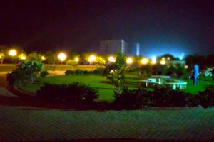
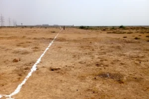
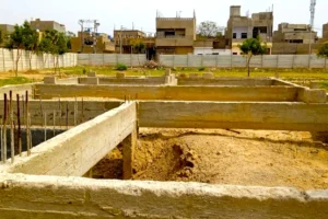
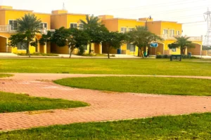
Image Gallery – Sector 2
What you’ll find in Sector 2
Legend
The Map of Sector 2 provides a legend with color codes for different land usages and plot categories:
-
Residential: Yellow
-
Commercial: Red
-
Commercial Mixed Use: Orange
-
Organic Farms: Light Green
-
Parks & Green Usages: Green
-
Nullah: Light Blue/Cyan (representing a natural watercourse)
-
Piazza / Pedestrian: Light Purple
-
Amenity: Grey
The legend also includes categories for Special & DHA Lands:
-
Special (Education & Healthcare): Dark Blue
-
Special (Marriage / Community Hall): Dark Purple
-
Special (Utilities & Installations): Pink
-
DHA Land: Brown
Road Network
The map highlights a structured road network within and around Sector 2:
-
CITY BOULEVARD (PA – 01): Forms the western boundary of the sector.
-
MAIN BOULEVARD (PA – 02B): Forms the eastern boundary of the sector.
-
WEST GATEWAY AVENUE (SA – 01): Forms the northern boundary of the sector.
-
WEST AVENUE 1W (PC – 01): Forms part of the southern boundary.
-
2ND Main Street North: An internal road running east-west in the northern part of the sector.
-
2ND Main Street West: An internal road running north-south in the western part of the sector.
-
2ND Main Street East: An internal road running north-south in the eastern part of the sector.
-
2ND Main Street South: An internal road running east-west in the southern part of the sector.
The internal road network appears well-planned, connecting different blocks and providing access to the main boulevards.
Features and Amenities
Several specific features and areas are labeled within Sector 2:
-
Nullah: A significant natural watercourse runs through the sector, with green areas often adjacent to it.
-
DHA LAND: A large area labeled as DHA Land is located in the northern part of the sector, for future development or other DHA purposes.
-
Sub-sectors/Blocks (A, B, C, D, C-1): The sector appears to be further divided into sub-sections (A, B, C, D, and C-1), which helps in organizing the plot distribution.
-
AN DEFENCE OFFICERS HOUSING SCHEME (DOHS): Located outside the western boundary, suggesting adjacency to another housing area.
-
Mosques: Masjid Quba and other mosques.
-
Dams: 4 Check Dams on Allama Iqbal River for flood control, water storage and management, and environmental benefits.
-
River: Allama Iqbal River.
-
Developments: TUMH Residency.
Plot Distribution and Estimation
-
Residential: Residential plots constitute a significant portion of the sector, spread across various blocks in sub-sectors A, B, C, and D. Sector 2 has over 1300 residential plots.
-
Commercial: Commercial plots are strategically located along the main roads and within some blocks, likely intended for retail and business activities. Sector 2 has over 65 Commercial plots.
-
Commercial Mixed Use: Areas designated for Commercial Mixed Use are also present, suggesting zones where both commercial and residential or other uses are permitted. These are seen in several blocks. Sector 2 has over 60 Mixed-use plots.
-
Organic Farms: Located in the northern part of the sector, along WEST GATEWAY AVENUE (SA – 01). These appear to be larger land parcels compared to typical residential plots, consistent with the “Organic Farms” label.
-
Parks & Green Usages: Extensive green areas and parks are distributed throughout the sector, often following the path of the Nullah, providing recreational space and enhancing the environment.
-
Piazza / Pedestrian: Designated areas for piazzas or pedestrian zones are visible, likely intended as public spaces.

