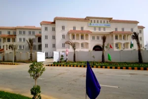
Sector 3 – DHA City Karachi
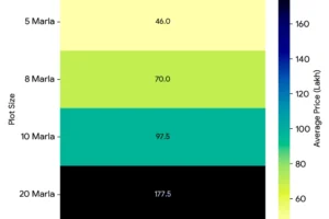
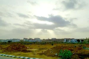
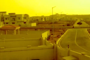
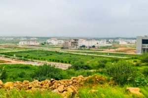
The most accessible and nearest from the main gate, Sector 3 of DHA City features the tail-end of Allama Iqbal Lake, and is further divided into 5 sub-sectors i.e. 3A, 3B, 3C, 3D, and 3E. Sector 3 offers a range of residential plot sizes, including 125 sq. yards, 200 sq. yards, and 500 sq. yards to cater to different housing needs and budgets.

Directions – Main Gate to Sector 3
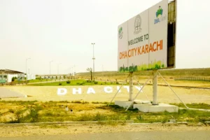
To reach Sector 3 of DHA City, you start by entering through the main gate. Upon entering, you immediately encounter a large roundabout called DHA Square. You go straight through this roundabout and continue onto the Main Boulevard (PA-02B), which serves as the main road within DCK. As you drive on the Main Boulevard, Sector 2 is on your right side, while Sector 3 is on your left. You drive for approximately 300 meters, and then you make a left turn onto ‘3A Central Drive West’ to enter into Sector 3. Sector 3 is conveniently located just 50 meters from the main gate, making it the most accessible sector in DHA City Karachi. It is also positioned just before the CBD Commercial area begins, on the opposite side of Sector 2, and north of Sector 6.
Plots for Sale in Sector 3
| Sector | Plot Size (Marla) | Plot Size (Square Yards) | Price Range (Crore/Lakh PKR) | Price Range (Million PKR) |
|---|---|---|---|---|
| 3D | 8 | 200 | 4.75 Crore | 47.50 to 47.50 Million |
| 3A | 20 | 500 | 1.40 Crore to 1.75 Crore | 14.00 to 17.50 Million |
| 3B | 8 | 200 | 8.80 Crore to 9.50 Crore | 88.00 to 95.00 Million |
| 3B | 20 | 500 | 1.35 Crore to 1.65 Crore | 13.50 to 16.50 Million |
| 3C | 5 | 125 | 42 Lakh to 55 Lakh | 42.00 to 55.00 Million |
| 3C | 8 | 200 | 56 Lakh to 73 Lakh | 56.00 to 73.00 Million |
| 3D | 5 | 125 | 36.5 Lakh to 45 Lakh | 36.50 to 45.00 Million |
| 3E | 5 | 125 | 32 Lakh to 41 Lakh | 32.00 to 41.00 Million |
*See the latest plot prices for Sector 3.
Image Gallery – Sector 3
What you’ll find in Sector 3
Plan Status and Date
-
The map is explicitly labeled as PROVISIONAL REVISED PLAN OF SECTOR 3.
-
It includes a reference: (AS PER LETTER NO. DHA/TP&BC/108/DCK/OCL – 09 SEP 2021), indicating that this is a revised plan as of September 9, 2021.
Legend
The map provides a legend with color codes for different land usages and plot categories:
-
Residential: Yellow
-
Commercial: Red
-
Commercial Mixed Use: Orange
-
Parks & Green Usages: Green
-
Nullah: Light Blue/Cyan (representing a natural watercourse)
-
Piazza / Pedestrian: Light Purple
-
Other Amenity: Grey
The legend also includes categories for Special & DHA Lands:
-
Special (Education & Healthcare): Dark Blue
-
Special (Other): Pink
-
Special (Utilities & Installations): Purple
-
DHA Other Lands: Brown
Road Network
The map highlights a structured road network within and around Sector 3:
-
MAIN BOULEVARD (PA – 02B): Forms the western boundary of the sector.
-
EAST GATEWAY AVENUE (SA – 02): Forms the northern boundary of the sector.
-
EAST AVENUE 1E (PC – 02): Forms the southern boundary of the sector.
-
3rd Main Street North: An internal road running east-west in the northern part of the sector.
-
3rd Main Street South: An internal road running east-west in the southern part of the sector.
-
3rd Main Street East: An internal road running north-south in the eastern part of the sector.
-
3rd Main Street West: An internal road running north-south in the western part of the sector.
-
3rd Main Street Central: Appears to be a central road running through the sector.
The internal road network connects the various blocks and features to the main boulevards.
Labeled Features and Areas
Several specific features and areas are labeled within Sector 3:
-
Nullah: A significant natural watercourse runs through parts of the sector, often bordered by green areas.
-
Sub-sectors/Blocks (A, B, C, C-1, C-5): The sector is divided into labeled sub-sections (A, B, C, C-1, and C-5), which helps in organizing the plot distribution.
-
GOTH ALLAHDAD: This label appears outside the southern boundary, adjacent to Sector 6, indicating a nearby locality.
-
3A Main Street South: A specific labeled internal road within sub-sector A.
-
3A Central Drive East: A specific labeled internal road within sub-sector A.
-
3B Main Street North: A specific labeled internal road within sub-sector B.
-
3B Central Drive: A specific labeled internal road within sub-sector B.
-
3C Main Street North: A specific labeled internal road within sub-sector C.
-
3C Central Drive: A specific labeled internal road within sub-sector C.
-
3C Main Street South: A specific labeled internal road within sub-sector C.
-
3C Central Drive South: A specific labeled internal road within sub-sector C.
-
3C Central Drive East: A specific labeled internal road within sub-sector C.
-
3C Central Drive West: A specific labeled internal road within sub-sector C.
-
3C Main Street West: A specific labeled internal road within sub-sector C.
-
3C Main Street East: A specific labeled internal road within sub-sector C.
-
3C Central Drive North: A specific labeled internal road within sub-sector C.
-
3C Main Street Central: A specific labeled internal road within sub-sector C.
Plot Distribution and Estimation
The map uses color codes to show the distribution of different plot categories across Sector 3 and its sub-sections:
-
Residential: Residential plots are the most dominant category in Sector 3, spread across sub-sectors A, B, and C.
-
Commercial: Commercial plots are strategically located along the main boulevards (MAIN BOULEVARD (PA – 02B), EAST GATEWAY AVENUE (SA – 02), EAST AVENUE 1E (PC – 02)) and some internal roads.
-
Commercial Mixed Use: Areas designated for Commercial Mixed Use are also present, particularly within sub-sector C-5 and other key locations, suggesting zones for mixed development.
-
Parks & Green Usages: Green areas and parks are distributed throughout the sector, often following the Nullah and providing open spaces.
-
Piazza / Pedestrian: Designated areas for piazzas or pedestrian zones are visible in several locations, likely intended as public spaces.
-
Amenity: Areas marked as Amenity are present, indicating locations for facilities or services.
-
Special (Education & Healthcare): A significant area is allocated for Education & Healthcare, notably within sub-sector C-5.
-
Special (Other): Areas designated as Special (Other) are visible, indicating land reserved for specific purposes not explicitly detailed.
-
Special (Utilities & Installations): Areas for utilities and installations are marked, essential for the sector’s infrastructure.
-
DHA Other Lands: Areas labeled as DHA Other Lands are present, potentially for future development or other DHA uses.
Estimating Plot Numbers in Sector 3:
- Residential Plots: Over 1000 plots
- Commercial Plots: Over 50 Plots.
- Mixed-use Plots: Over 40 Plots.
Other Observations
-
Transferred plots from the Shuhada Land allocation are located in Sector 3D and 3E.
-
The sector’s layout appears well-planned, with a clear road hierarchy and dedicated zones for different land uses and amenities.
-
The presence of a Nullah is a natural feature integrated into the design, with surrounding green spaces.
-
The “PROVISIONAL REVISED PLAN” label indicates that this is an updated plan and might still be subject to further revisions before finalization.
-
The sector is bordered by major boulevards, providing good connectivity.
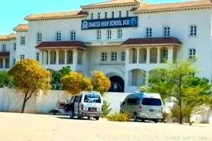
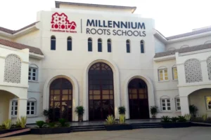
- Education: Defence Housing Authority College & School System DHA City Karachi Campus (DHACSS DCK Campus), a primary and secondary school. Roots Millennium School DHA City Karachi Campus.
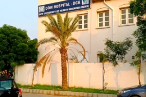
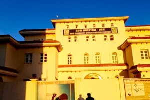
- Healthcare: Dow Hospital DHA City.
- Commercial Areas: 5 Commercial areas namely C1, C2, C3, C4 and C5.
- Recreational Spaces: 9 parks and playground dedicated spaces in the entire sector 3.
- Piazzas and Community Halls: At least 6 dedicated spaces for Piazzas and community halls.
- Mosques: 3 dedicated spaces for mosques in C3, C4 and C5 Commercial areas.
- River: Allama Iqbal River.

